-
 ×
- Hjem
- Kunstt Tryk ▸
- kunstnere ▸
- Kategorier ▸
- Kunst Stilarter ▸
- Billedramme ▸
- Tryk medie ▸
- Alle trykmedier
- Lærred Leonardo (satin)
- Lærred Salvador (mat)
- Lærred Raphael (mat)
- FineArt Foto Mat
- FineArt Foto Satin
- FineArt Foto Baryte
- FineArt Foto Blank
- Akvarel Karton Munch
- Akvarel Karton Renoir
- Akvarel Karton Turner
- Akvarel Karton Dürer
- Natural Line Hemp
- Natural Line Rice
- Kozo White, 110g
- Kozo Natural, 110g
- Inbe White, 125g
- Unryu, 55g
- Bamboo, 110g
- Premio Unryu, 165g
- Murakumo Natural, 42g
- Bizan Natural, 300g
- Bizan White, 300g
- Aluminiumskomposit 3mm
- Akrylglas 5mm
- Bestil prøvesæt
- Hvilket trykmedie passer?
Lærred
Fotopapir
Akvarelkarton
Natural Line
Japansk papir
Særlige medier
Mere information
- Hjælp & Service ▸
- Kontakt os
- Sælg din kunst
- Ofte stillede spørgsmål
- Ledige stillinger
- Reklamation
- Bestil prøver
- Bestil gavekort
- Forsendelsesomkostninger
- Produktionstid
- Bæredygtighed
- Billedsøgning
- Særlige ønsker
- Hvem er vi?
- Prispolitik
- Virksomhedspolitik
- Kvalitetsløfte
- Udmærkelser
- Blindramme
- Passepartout
- Dekorative rammer
- Glas
- Lister
- Ophængningssystemer
- Trykmedier
- Plejetips
- Aftryk
- V&B
- Databeskyttelse
- Fortrydelsesret
Info og service
Mere information
Værd at vide
Juridiske oplysninger
- Shop ▸
- Kontakt


 Se i 3D / AR
 Føj til favoritterMine favoritter
 Vælg vægfarve
 Se maleri i et rum
.jpg "Alfabetisk tabel med navne på byer, landsbyer osv. som er på kortet over hollandske Gelderland osv. af sr. Sanson")


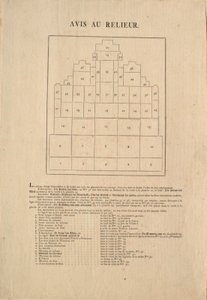


.jpg "Grundplan for de tretten markeder i byen New York, 1833 (sort blæk, med farvevask, på papir)")


.jpg "Høiderne af de hidtil maalte Bjerge")


.jpg "Geologi, 1833-39")
.jpg "Afstamning af de europæiske herskere fra kejser Ferdinand I og kong Rudolf I af Habsburg")


.jpg "Plan over den kongelige mønt i tårnet, 1701")


.jpg "Oksekød: diagram over de forskellige udskæringer")

.jpg "Achilleus")


.jpg "«Manden med seks hoveder», karikatur af Charles Maurice de Talleyrand-Périgord (1754-1838), 1815")


 - (MeisterDrucke-89706).jpg "Verdenskort, baseret på beskrivelser og koordinater i «Geographia», først udgivet i Ulm, Tyskland")
 - (MeisterDrucke-106028).jpg "Kort over De Store Søer (pen og blæk og wc på papir)")

.jpg "BT1.47.9 Dedikationen til dronning Elizabeth I fra en bog med kort over England og Wales af Christopher Saxton, udgivet 1579")
.jpg "Kort over Mexico og Mellemamerika, fra")
 - (MeisterDrucke-153535).jpg "Kort over Cambridgeshire, udgivet Amsterdam c.1647-48 (håndkoloreret gravering)")
 - (MeisterDrucke-219723).jpg "Kort over Asien, udgivet i 1700, Paris")

 - (MeisterDrucke-69388).jpg "Kort over Fisk-Kill og den franske hærs stilling i 1782, fra «Guerre de l")
.jpg "Kort over Charleston, South Carolina, 3. august 1781")


 - (MeisterDrucke-191935).jpg "Kort over Indien, udgivet af William Blackwood and Sons, Edinburgh og London, 1848")
 (detail from 330960) - (MeisterDrucke-120039).jpg "Mellemamerika, fra et verdensatlas i 33 kort, Venedig, 1. september 1553 (blæk på vellum) (detalje fra 330960)")
 (detail from 330946) - (MeisterDrucke-115920).jpg "Etiopien, Det Røde Hav og Saudi-Arabien, fra et verdensatlas i 33 kort, Venedig, 1. september 1553, detalje fra 330946")


.jpg "Amor som sejrherre")


.jpg "Damen fra Shalott")

.jpg "Venus")
.jpg "Kristus sovende i sin båd")


 +43 4257 29415
 support@meisterdrucke.com
 Mo-Do: 7:00 - 16:00 | Fr: 7:00 - 13:00